Danvers.
North Shore · Massachusetts
Overview
Welcome to
Danvers.
Danvers sits right at the crossroads of the North Shore, about 20 miles north of Boston, and it wears a lot of hats well: a walkable town center with local restaurants and shops, quiet residential neighborhoods, a working waterfront on the Danvers and Porter rivers, and one of the region's most convenient retail corridors along Routes 1 and 114. For buyers who want an established Essex County community without giving up everyday convenience, Danvers is consistently one of our first suggestions.
The housing stock covers a wide range. You'll find center-entrance colonials and capes on tree-lined side streets, classic antiques in and around the Salem Village Historic District, ranches and split-levels from the town's postwar growth years, and condos and townhomes that give downsizers and first-time buyers a foothold. Danversport adds something few inland-feeling towns can offer — marinas, river views, and quick access to the water.
Commuters have real options. Interstate 95 and Route 128 both run through town, with US Route 1 and Route 114 handling local and regional trips. There's no commuter rail station in Danvers itself, but the Newburyport/Rockport Line stops in neighboring Salem and Beverly are a short drive away, and MBTA bus routes 435 and 436 connect the Liberty Tree Mall area through Peabody to Lynn. Logan Airport is roughly a half-hour ride on a good day.
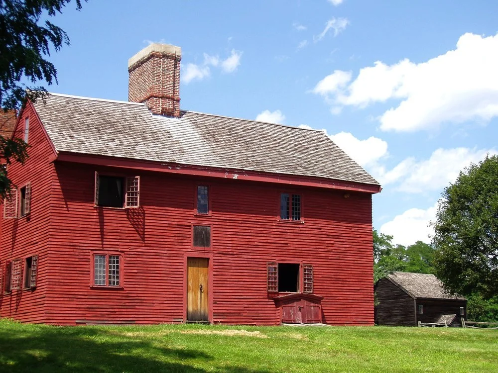
When you're not commuting, Danvers gives you plenty to do close to home: the Rebecca Nurse Homestead and the town's deep Salem Village history, 165-acre Endicott Park with its barn and playgrounds, and the Danvers Rail Trail, a 4.3-mile path linking the schools, downtown, and neighboring towns' trail networks.
Danvers, MA 01923 · Sherwood & Company at Compass
Points of Interest
What locals
love here.
Market Snapshot
The Danvers market,
read in seconds.
Figures cover Lofty (MLS-sourced) · Danvers, MA · Single Family Homes, refreshed automatically from MLS data.
See the full live market snapshot ↗
About these numbers
Figures cover single-family homes in Danvers, MA, sourced from MLS data via the Lofty API. Median sale price, price per square foot, and homes sold reflect the trailing 12 months; year-over-year compares that window to the 12 months before it. Median days on market is computed from each sale's list-to-close date, not Lofty's raw "days on site" field, which tracks total listing lifetime rather than time to sale. Ask us for a current, address-specific valuation.
Schools
Learning in
Danvers.
Danvers Public Schools operates five neighborhood elementary schools — Great Oak, Highlands, Riverside, Smith, and Thorpe — serving kindergarten through grade five, with the district's Little Falcons Preschool rounding out early education. Students move on to Holten Richmond Middle School for grades six through eight and then to Danvers High School.
The town is also a private and vocational education hub for the North Shore. St. John's Preparatory School, a Xaverian Brothers–sponsored Catholic school for boys in grades six through twelve, draws students from across the region, and St. Mary of the Annunciation School offers a Catholic PreK–8 program. Essex North Shore Agricultural & Technical School, the regional vocational district that opened its unified Danvers campus in 2014, offers agricultural, technical, and trade programs to area students.
A Short History
Settled in 1636 as Salem Village, Danvers was farmland for its first century and stood at the center of the events of 1692, when villagers including Rebecca Nurse were swept up in the Salem witch trials. The town incorporated in 1757 — local tradition holds that the Crown declined to approve the charter, and "The King Unwilling" still appears on the town seal. Danvers stayed agricultural long enough to lend its name to the Danvers half-long carrot and the Danvers onion, turned to shoemaking and other manufacturing in the 19th century, and grew into the residential and commercial community it is today.
Location
Getting here,
getting around.
Danvers occupies the center of southern Essex County, about 17 miles north of downtown Boston and roughly four miles northwest of Salem. It shares borders with Topsfield to the north, Wenham to the northeast, Beverly to the east, a short stretch of Salem to the southeast, Peabody to the south and southwest, and Middleton to the northwest — a location that puts nearly the entire North Shore within a 20-minute drive.
Free monthly digest
The Danvers market, in your inbox.
One email a month: what sold in Danvers, what it went for, and what tax and market moves mean for your home. No spam — unsubscribe anytime.
Ready when you are
Let's talk
Danvers.
Buying or selling in Danvers? Every market here has its own rhythm — reach out and we'll connect you with the person on our team who knows this one best.
Sherwood & Company · Team @ Compass · Sherwood & Company at Compass
Explore every town we serve across Greater Boston.

North Shore
AndoverBeverlyBoxfordChelseaDanversEssexEverettGloucesterHamiltonIpswichLynnLynnfieldManchester-by-the-SeaMarbleheadMiddletonNahantNorth AndoverNorth ReadingPeabodyReadingRevereRockportRowleySalemSaugusSwampscottTopsfieldWakefieldWenhamWinthropWest of Boston
AshlandBrooklineConcordDedhamDoverFraminghamHudsonLincolnMarlboroughMaynardNatickNeedhamNewtonSouthboroughStowSudburyWalthamWatertownWaylandWellesleyWestboroughWeston© 2026 Sherwood & Company · real estate services through Compass · Equal Housing Opportunity. Market figures on this page are sourced from MLS data via Lofty and refreshed regularly; they do not represent a specific listing, sold price, or appraisal.